Underway to Gambier Islands

The wind was due to pick up. It had been light NE for two days which we enjoyed to the maximum in the dreamy paradise of Oeno Atoll. Now the N wind would strengthen in anticipation of a series of small fronts heading to our latitude. So it was time to go!

We were still at anchor in Oeno when I awoke at 4am with the wind blowing moderately from the NW. This would mean a bumpy and slow “close haul” to Gambier. Oh no!

Luckily, by 8am when we raised anchor it had veered back to the N at 10 knots, and we were delighted to raise the reacher and mainsail and get under way at 4 knots of boat speed, in smooth seas and partly sunny skies. Nice!

Sabrina got inspired and began a culinary extravaganza in the galley. From the chickpeas she had begun soaking the previous day, she made from scratch falafels and humus, shelling each chick pea with Buddha-like patience to ensure smoothness in the humus. She also made pita bread and fresh yogurt. We chopped the gigantic cucumbers from Pitcairn Island, and voila! A delicious falafel feast was had that night.

Along with a glass of sauvignon blanc, motivated by Mr. Payne, we were eating in true style. We felt blessed as Aldebaran sailed smoothly under the starry night, once again stretching her legs, heading straight to our destination. The passage from Oeno Atoll to Gambier Islands is 250 nautical miles, which we could do in two nights usually. However, given the uncertainty of the conditions, we expected to complete this transit in three nights…. at which time we would reach our first truly sheltered anchorage in 30 days… and finally arrive in French Polynesia.

Giant clams in Oeno

“Like smiles in the rocks”, some of the clams had black lips, others bright blue, while some were green or purple. Swimming over the reef, their wavy lines caught our eye – here, there, everywhere! Like standing behind the glass of an ice cream shop, admiring the multitudes of flavors and colors, and not being able to decide where to look…

Underwater life in Oeno

Water so clear feels like you are floating in air!

In just 3 feet of water we found a beautiful array of colorful fish, giant clams, and many varieties of coral. The coral had many passages and tunnels where fish hide. There is a mesmerizing amount of detail by sticking our heads close up and watching the underwater life go by. The only thing getting us out of the water was the pruniness of our fingers 🙂

Further offshore near where Aldebaran was anchored, the reef was in deeper water, more extensive, and the fish were larger; but we really enjoyed the shallows, getting close to the coral to observe all the details.

Bob the Giant Trevally

“Ahh! A shark!” Yelped Sabrina as she was standing in knee deep water when a fin went by cresting the surface only a couple feet away. In the clear, transparent waters, she quickly realized it wasn’t actually a shark. “Holy moly, that is one giant fish!!”

It was a 4-foot long Giant Trevally Jack, incredibly girthy, and incredibly curious. He was doing circles around Sabrina and Michael, who were wading in the shallows.

“He just seems to swim around us in an anti-clockwise fashion,” noticed Michael. “We are in the Southern Hemisphere after all.”

This intriguing fish decided to spend the entire afternoon with us.

“He’s our new pet in Oeno!” said Sabrina, happy as can be.

Both parties completely intrigued by one another. This was by far the most novel thing any of us had seen in awhile! Such unusual behavior for a fish. He acted like a playful dog, hanging out with us wherever we went.

The best was when Captain K was standing in the shallows and the giant fish swam right between his legs. “Waaaaahhh!!” Kristian hollered and tried to untangle himself as they both seemed to splash wildly avoiding one another in the commotion.

We named him Bob. Otherwise known as Big Bob, our first of the South Pacific! 🙂

Oeno Atoll 10 Fun Facts & Observations

1. Fish biomass 1.7 Ton per Ha, equal to that of well protected marine reserves. 2. Lacking sharks, which suggests past illegal fishing
3. Patch reefs in lagoon host up to 10 giant clams per square meter. Predators like groupers and jacks were abundant
4. Currents bring some trash onto the beaches in the form of fishing floats and crates.
5. Bright red hermit crabs love to eat papaya we leave behind. Tropic birds love to eat the hermit crabs that get too close.
6. Hundreds of birds – including a few types of boobies – all nesting on the ground suggesting a lack of invasive species like rats.
7. Pine trees are growing in the island, probably planted by the Pitcairners who use the island as an occasional vacation spot (but apparently haven’t visited in years due to lack of crew to drive the long boats) 8. Waves wrap onto the fringe reef with nice shape.
9. Mosquitos or no-see-ums were non existent!
10. Yes, we are already planning our Eco-lodge in Oeno.

Source of Science Facts #1-3: poster in Pitcairn Island Museum from scientific study conducted in island chain.

Photo: Sabrina taking her first observations of this astounding place.

Dinghy ride to Oeno

We had to keep pinching ourselves: “Is this real?!” As we entered the lagoon, motoring the dinghy 1 mile from Aldebaran to shore, the colors just became more insane.

We had arrived at an iconic South Sea paradise. Coconut palms leaned over the white sand beach which separated the aquamarine crystal clear water from the dense palms & pine trees of the island vegetation that was home to thousands of birds that flew overhead and nested on the ground.

When we arrived it Pitcairn after sailing 3 weeks, with just ocean and sky, it felt like we had entered a parallel universe into a wayward civilization. Now we had just crossed a magic portal and arrived in Oeno, our first atoll of the South Pacific.

—-

Read more about the Pitcairn Islands and our voyage:
http://www.greencoconutrun.com

Enjoy the photos, videos, and recipes on Green Coconut Run? Support by becoming a Patron and get sweet perks: http://www.patreon.com/greencoconutrun

—-

PHOTO: Sabrina, Kristian, Spencer, and Michael on the “Lambordinghy”, getting ready to land in Oeno. Photo upload by satellite.

Finding Oeno Atoll

Like a puppet on a string, Aldebaran was tugged north by the lines driving her headsail. We were sailing 75 nautical miles from Pitcairn to Oeno atoll (at 5 knots, this is 15hours, which is a good overnight sail).

At 11am of the next day, we saw it. A scattering of trees lay just above the horizon. In comparison to the conspicuous Pitcairn, which was shaped like a proud wedding cake, this atoll was just a slender pancake.

Our friends from the Swiss sailboat SV Maya (a couple with kids ages 5 and 7) told us: try to stop at Oeno, even if only a few hours. We needed this motivation, because the weather was turning from SE wind (stable high pressure) to N wind (unstable low pressure). We kept fingers crossed that by gaining ground heading north to Oeno, we’d have an OK point of sail to Gambier – which is the first true sheltered anchorage since we left Galapagos – and we wouldn’t get stuck with head winds.

Oeno is an atoll with a coral fringe reef about 2 miles in diameter. Inside this reef is a lagoon, and within the center is a slender teardrop of land, a mile long, but fairly narrow. It is a little island inside the protected waters of the lagoon.

It is very disorienting to approach a fringe reef, which is a submerged hazard. It is visible only by the white water from breaking waves. This is deceptively distant from the land that we see in the horizon. With our nautical charts, depth sounder, and radar, we’re able to safely navigate around the reef to the pass on the northern side.

To figure out the location of the pass (access through the reef) into the lagoon was not straightforward. Here we can thank our friends on the catamaran Pakia Tea (pronounced Teh-ah), a traditional polynesian style sailboat. They are an Austrian family with a 3 year old son who we met in Galapagos. They had spent time downloading Google Earth overlays of all the atolls in eastern Polynesia. It seems unlikely, but the satellite imagery is actually very helpful for us to find safe anchorage; by identifying areas of sand (bright green) instead of rock and reef (shades of blue).

We picked a sandy spot on the Google Earth overlay, noted its Latitude and Longitude, and plugged that location into our Raymarine Navigation display to steer the boat. We discovered a good sandy bottom in 50 feet of water, with appropriate distance from the shallow reef. On the north side of the atoll, the swell is much reduced, as the brunt of the waves in the Southern Hemisphere is coming from the South.

At this point, with anchor down, I finally took a breath and looked at where we were. It was a dreamscape! The cobalt blue of deep water became textured with every shade of cyan and turquoise in the turbulent wavelets of the reef pass. Past that, a band of the softest green-aquamarine butted against the strip of white sand and trees growing on the island. Puffy clouds framed the picture of paradise that lay before us. Now it was time to get in the skiff and see if this atoll was as idyllic as it looked from afar.

Photo: Oeno atoll. Nautical chart on left, Satellite overlay on the right. Our approach is the line in blue and anchorage at the top of the atoll.

GOODBYE PITCAIRN

By Michael. Goodbye my new dear friend. It is so hard to say goodbye. I just met you five days ago and already you have made me feel part of your family. You have been so kind, so hospitable so welcoming. I understand that you meet few new people and so all are special. But you made us feel particularly so as if to say ” please stay” . We’d love to. We know you need new friends, new families, to bring new energy and vitality to Pitcairn. But do you really? You are a family split between Christens and Warrens. Would we as outsiders be welcome? We would bring new ideas, new directions. Would they be welcomed? Could we all live as one?

You live in one of the most beautiful places on Earth. The sub tropical climate is inviting, your land rich and perfect for almost every crop, fruit, and flower on the planet; and your distance from the rest of the world refreshing. But also challenging. The inability to leave when you want, arrive when you chose is a problem. Three months between ship visits is just too long. Especially when you’re sick or there is an event you must attend. It’s too much. Sorry, but the time to stay hasn’t quite arrived. But you won our hearts and when we left and said ” until next time” we meant it. We love you Pitcairn!

Tedside anchorage, our last stop in Pitcairn

It was a relief to get around the northern side of the island, protected from the full brunt of the SE wind and swell.

The coastline had a lonesome feeling. A stony promontory was cut by gulleys of bushy trees, which clung to the vertical cliff. A large offshore pinnacle had an unusual arch with a rock suspended in its grasp.

The ocean here was rippled with texture but very smooth compared to the mayhem of Bounty Bay just around the corner. Looking over the bow, we could clearly see the sand in 60ft of water at the recommended outer anchorage, but chose to drop the hook in the placid calm of the inner anchorage. We knew the holding ground in this inner anchorage was poor – a predominance of rocks and some sand – but it was a temporary stop. We planned to leave that same night for Oeno Atoll.

We snorkeled in the clear but somewhat featureless waters; then hiked on shore, discovering an array of tide pools. As the sun set we returned to the boat and weighed anchor (with some difficulty, as it was snagged in the rocks!)

In the dim twilight, the blue reacher headsail was hoisted and Aldebaran was again underway, heading north with SE winds to our back. Under the red glow of our night lights, Sabrina served up a delicious curry with the produce harvested from the island.

Behind us Pitcairn Island fell away, a grey mass in the horizon. The few lights of Adamstown twinkled in the darkness. Their isolation was heightened: a little speck of civilization on the side of a huge rock, stuck out here in the middle of the Pacific.

Indeed, their isolation has a terrible side. Even though the people are extraordinarily hospitable; their self-reliance and homesteading abilities remarkable; and the island a verdant garden blooming with food in every corner; we can’t glaze over the reality that emerged 12 years ago: this is a community that allowed child sexual molestation and rape to occur for many years.

The details of this investigation can be read online (they made a media frenzy). More than a dozen men were prosecuted and brought to justice. Now it remains to be seen whether this rule of law has lasting effect –and the community changes forever.

The locals believe a positive change is occurring. Pitcairn is already rising from that dark period in its existence. It will experience a renaissance driven by newcomers. In our crowded, modern world, people increasingly admire what Pitcairn has to offer: a simple healthy lifestyle, a real connection with your food, and beauty that your eyes can feast on.

As the night squeezed down on the horizon, like blowing candles out, the lights of Pitcairn disappeared. We were left, once again, alone under sail. We turned on our masthead light. Somewhere in the distance, Pitcairn has its own navigation light, steering a course into its unique future. We hoped our paths would intersect once again.

ALDEBARAN POSITION
Enroute to Oeno Atoll, 75 nautical miles away, part of the Pitcairn Group.
Going north-west at 5knots, wind south-east 12 knots, rolling seas, clear starry night.

A Rough Day in Bounty Bay

“I’ll stay on the boat while you guys do the last chores,” I told Sabrina. “It’s too nasty out here.”

It was our fifth and last day in Pitcairn. From inside the cabin, it felt like our 42ft trimaran Aldebaran was sailing upwind mid-ocean: smashing through waves, heeling over with the swells. The SE wind had accelerated to 15 knots with occasional 20 knot gusts, and white capping windswells sent our amas flying with disturbing frequency. At anchor, mind you!

“This is the Bounty Bay anchorage that everyone fears,” commented Spence with a smile. But our crew wanted to do a few more things in Adamstown – buy souvenirs, see the Pitcairn honey-making process, give the doctor a culture of Kombucha, and pick up laundry which our friends Simon and Shirley kindly washed for us. Afterwards, we planned to move to the more sheltered anchorage in the north, called Tedside. After all, there was no way we’d be able to hoist the dinghy and outboard onto Aldebaran in these unruly conditions, straight out of the “Top 5 crappiest anchorages” textbook.

The day prior, we had a surprise. “We have some mail for you,” said Charlene, the port captain. “Huh? Come again?” I had asked, baffled. “Someone sent you an email.” She handed me a print-out which read:

“Kindly request sailing vessel Aldebaran to contact us if they are in the island.”

We felt rather important for a moment! It was a catamaran called Duplicat, almost 5 weeks out from Panama, who had been following our blog by satellite, so they knew we were here. Unfortunately, they arrived on the same day as the strong SE wind…

I gave the three British crew members a ride to shore in the Lambordinghy – they were all looking a bit wide-eyed with the hectic-ness of getting into the skiff in this wild anchorage. Comparatively, the ocean was much less dangerous!

The crew of Duplicat spent the day exploring and then got underway that night; since there was a north or north-west wind in the forecast. I can understand why they wanted to get to Gambier’s calm lagoon after being so long at sea! Our passage of 3 weeks had been short in comparison, since we had stopped in Galapagos.

Duplicat’s visit, as short as it was, is expected by the locals. In fact, on our very first day in Pitcairn, a monohull sailboat from Easter Island also spent 8hrs and then took off. The poor monohull was rolling severely in Bounty Bay, and the anchoring conditions are quite intimidating. Whether they knew about Tedside anchorage or not, it was blowing light N wind and wouldn’t be super smooth there either.

We were grateful for our trimaran’s stable feet. We were actually quite fine, and for this we were able to stick around for a few days.

“You guys are very lucky to be able to stay for so long,” commented Charlene about our 4 nights in Pitcairn. We all agreed it was barely enough to scratch the surface. And to think we were only the 12th sailboat to visit Pitcairn this year! I believe that with the information from our Cruising Guide to Pitcairn, it is possible that more yachts will feel confident to visit the island and spend more than a few hours.

We since discovered that non-residents pay an exhorbitant fare of NZ$2500 each way (yes, double for roundtrip…) to go from Gambier’s port of Mangareva to Pitcairn Island. That is the charge by the Cargo Ship to bring visitors to the island, and locals get that rate subsidized and pay only (!) NZ$1500 — whether going to Mangareva or all the way to Auckland.

The obstacles to visiting this island are truly formidable. If not financial, then they are in the form of marginal anchorages. Yet its these challenges that make Pitcairn so special – precisely because it is so hard to visit. You really have to want to come here! So we dealt with bumping around in the anchorage for a few days, it seemed like a small price to pay for such a rare honor of visiting one of the smallest nations in the world (is there a nation with fewer residents than 49 people??)

Bounty Bay, farewell. Tedside, and your smoother waters, here we come!

—> Read more about Pitcairn and our voyage:
http://www.greencoconutrun.com/blog

—> Enjoy the photos, videos, and recipes on Green Coconut Run? Support by becoming a Patron and get special gifts: http://www.patreon.com/greencoconutrun

Photo: Aldebaran showing her undersides, thanks to some steep windswell in Bounty Bay. (Photo upload by satellite)

Water view of St Paul’s Pool

We’ll post better quality photos once we get to civilization! In the meantime get another taste of the phenomenon of St Paul’s Pool from the water’s edge. You are looking west at the rock pinnacles jutting out, acting as sentries to this watery “fortress”. But as high tide and swell reach a critical point, they blast through the gates of the fortress with dramatic spray and white water. The contrast between the placid pool and the detonating water is mesmerizing.

(Photo uploaded by satellite.. I’m trying to upload at slightly better quality but the poor system keeps timing out! Our bandwidth is only about 12kb per minute…)

Water view of St Paul’s Pool

We’ll post better quality photos once we get to civilization! In the meantime get another taste of the phenomenon of St Paul’s Pool from the water’s edge. You are looking west at the rock pinnacles jutting out, acting as sentries to this watery “fortress”. But as high tide and swell reach a critical point, they blast through the gates of the fortress with dramatic spray and white water. The contrast between the placid pool and the detonating water is mesmerizing.

(Photo uploaded by satellite)

St. Pauls Pool

By Spencer.
On our third day in Pitcairn, we hiked to a magnificent natural ocean pool called St. Paul’s. The hike sported 360º views of the island including a stop off at the lookout over Bounty Bay where we paused for incredible pictures.

The paths that took us to our swimming hole were lush and quite beautiful; we passed through tunnels of trees and ferns and groves of Norfolk Pines. Towards the end, the hike traversed through a barren landscape of red clay. We eventually made it to a long staircase leading down to one of the most majestic places on earth.

The pool was formed by a natural rock barrier separating it from the open ocean, at the extreme south-eastern corner of the Island. At one end of the pool was an opening where water would flow through – or should we say, “detonate” through. It sported two enormous vertical pinnacles rising some hundred feet out of the water; between these, large waves that had traveled thousands of miles came bursting though the narrow passage with a bang sending water skyward in the most dramatic display of waterworks.

The opposite end of the pool was a rushing river with multiple waterfall rapids waiting to suck out unsuspecting fish or tourists- good thing we were the only ones! The water was a blue that has to be experienced, to be understood; and the clarity was better than a glass of water. The aquamarine blue contrasted beautifully with the red clay in the cliffs towering high above.

A few dozen fish swam through the pools and the coral-studded bottom. Natural jets would erupt from underwater lava tubes filled with trapped air and froth to the surface of the pool; this made a great source of amusement if one sat upon one of the jets.

Swimming here felt like swimming on the edge of the earth… as if straddling the ocean’s might yet safely in the cusp of Pitcairn Island. St. Paul’s left an impression on us that will last a lifetime.

Cruising Guide to Pitcairn

For other sailors interested in visiting Pitcairn… we highly recommend it! Here’s our suggestions based on our five day visit in May 2017. It’s worth noting that Pitcairn’s language is English and they monitor VHF CH 16 closely.
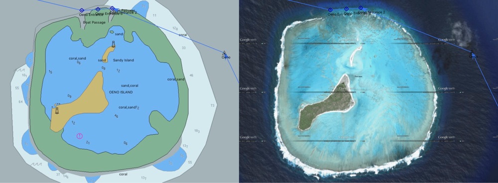
ANCHORING
This is the main concern for most sailors interested in Pitcairn. Many sailboats leave too soon or don’t visit at all because of confusion over the anchorages.

There are 3 anchorages ranging from ok to rolly to very rough. A multihull helps a lot. Monohulls will want to spend more time at Tedside, which is farther from town.

Climate:
– Pitcairn is at 25 degrees south so there’s a light nip in the air at night, the water is warm at 78 F and can be extremely clear.
– Better conditions are found in summer months (Dec-Mar) when trade winds are more reliable and S swells are smaller. – Tropical storm activity very rare.

Winds:
– The predominant trade winds are E and SE.
– Winds with any W don’t last long, associated with passage of fronts.
– N winds can blow for a few days when a low is passing to the south of Pitcairn.

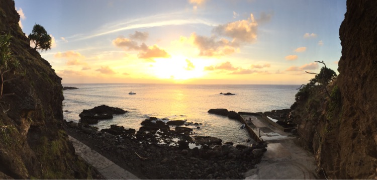
Bounty Bay anchorage:
– Located on the eastern side of island by the main landing and Adamstown jetty.
– Anchor in sand with patchy rocks in 35-45ft off the jetty area, excellent holding.
– Further offshore it is mainly coral (maybe more sand far away, but we didn’t look).
– Very easy to identify sand and rocks, even at night with half moon. The water is very clear. – Protection from W, SW, S winds, but always seems rolly.
– Manageable but rough with E or N wind 10kts or less, but probably too rolly for monohulls.

Tedside anchorage:
– aka Western Harbor in charts, northern side of island. 1nm from Bounty Bay.
– Anchor in 30ft (inside, varied rock, sand, coral) or 60ft (outside, sand with patchy rocks).
– The inside anchorage is most comfortable in entire island, but holding ground is questionable and anchor can get stuck in rocks. Smooth water.
– The outside anchorage has more wind exposure but worth it for the better holding if leaving the yacht unattended, or if unable to dive on a fouled anchor. Light wind bump but not bad under trade wind condition. – Water is very clear
– Protection from S, SE, E winds (predominant trade winds)
– Not good shelter in other wind directions.

Downrope anchorage:
– aka unmarked anchorage in SE corner of island in charts, 1 nm from Bounty Bay. – anchor in 45-60ft.
– Significant exposure to S swells, anchor in deep water if swell above 1.5m; watch swells for 20-30minutes before anchoring. – Water very clear but seems more turbid due to wave action in cliffs – Protection from NW, N wind.

Gudgeon/John Mills anchorage:
– Western side of island
– we did not evaluate these anchorages but appear to be the only place with true protection from NE wind. – there is a lot of exposure to S swell
– Holding ground unknown

DINGHY ACCESS
Ok, now that you’re anchored, how to get to shore safely?

Bounty Bay access:
– Pitcairn offers pickup with their large skiff for $50/roundtrip, can be shared with multiple boats.
– With SE or any E or N wind, it can be very rough to get from sailboat to dinghy.
– With your own dinghy, the breakwater entrance is fine if swell is small (<2 meters from S).
– If swell is medium to large, rollers will occasionally cap with white water across harbor entrance (about 35ft wide) especially on low tide, but they don’t crash with force, ok to navigate depending on skill/dinghy type/swell size.
– Jetty has a hydraulic boat hoist so dinghy can can be hoisted out of water with a three point attachment (good for RIBs).
– Otherwise, would recommend stern anchoring to keep dinghy off the jetty in surge (cement with rubber tires).
– The boat ramp for Pitcairn’s longboats is way too steep for a dinghy with wheels. – From jetty, steep but nice 10min walk on paved road to Adamstown.

Tedside access:
– New jetty built (2017)
– Need to use own dinghy; Pitcairn did not offer pickup by skiff – Need to stern anchor dinghy at the jetty, no boat ramp or hoist
– To get to Adamstown, will need taxi (typically an ATV/Quad, but might be a closed vehicle). – Walking distance from town is about 1.5-2hrs estimated, steep hills.

Downrope / Gudgeon / John Mill access:
– no landing
– steep cliffs and large surf breaking on beach

MONEY
– Customs. $50 per person to enter island. Covers immigration and customs. All can be done upon arrival. – Currency. Major currencies accepted but change given in NZ dollars. – Credit cards. Accepted with 5% fee.
– ATM. None on island, but debit card with Visa/Mastercard logo can withdraw money (also 5% fee)

PROVISIONS
– Limited diesel may be available (10-20gallons) at US$7/gallon, BYO jerry cans
– General store has an impressive selection of food and kitchenwares, at very reasonable New Zealand prices. Open mornings on Tue, Thu, Sun, or by request.
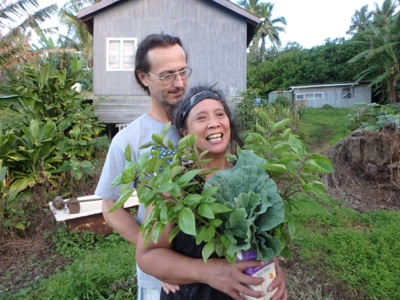
– Seasonal fruits and veggies can be acquired from locals at good value (we got two large boxes for $40) – Fresh bread from Daralyne
– Hardware store has good selection of items at New Zealand prices.

HEALTH CARE
Very well appointed health clinic with on-call doctor 24/7, open otherwise Tue, Thu, Sun.
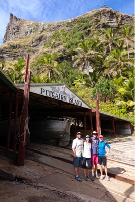
ADAMSTOWN
(Most places are open for business on Tuesday, Thursday, and Sunday mornings, or by request)
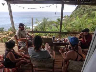
– Lunch at Daralyne’s. By request in advance. $20pp, a huge spread with dessert, good for two meals! – Museum, $5pp. Open mornings Tue, Thu, Sun or by request
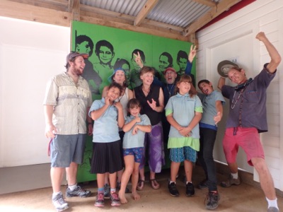
– School. Go chat with the kids, it’s a lot of fun!
– Honey. Purchase astoundingly delicious honey jars (and propolis) and request to see bee hives and honey process in highlands.
– Souvenirs. Usually kept packed away for the cruise ship visitors, you need to request to see them! Wood carvings from Henderson Island timber, Bounty ship models, shirts, fridge magnets by local school kids. – Post office: very cool stamps and postcards. Open Tue, Thu, Sun.
– Pizza at Andrew’s. By request in advance. $12-14 each pizza, views from highland. – Internet. Very slow connection available at $40/ 400MB
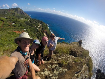
HIKES
(all are free of charge):
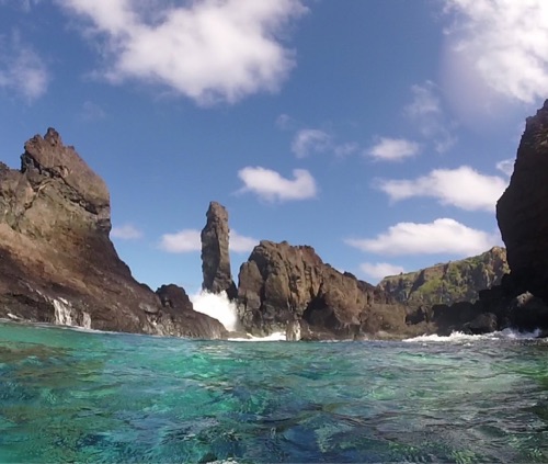
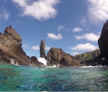
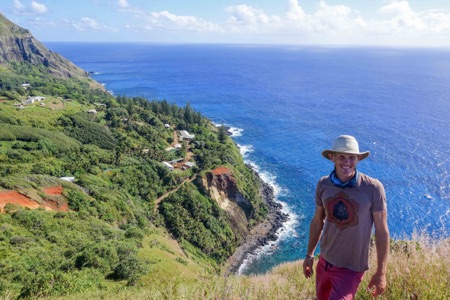
– St. Paul’s Pool. 1hr hike each way. Mind-blowing natural swimming pool in a powerful setting. Best low-ish tide with smaller swell, up to 2pm for sunshine.
– The Spire. 40 min hike each way, on the way to St Paul’s Pool. This is the outstanding peak directly above the boat landing at Bounty Bay, incredible views. – Christian’s Cave and eco-trail.
– Other hikes are also available from the map.

GIFTS FOR THE ISLANDERS
– movies, music, TV shows
– Magazines, books
– Educational Stuff for the school kids (ages 7-12)

Read some of our blog posts about our visit to Pitcairn:

– Day 22. Land ho! https://greencoconutrun.com/2017/05/01/day-22-land-ho-pitcairn-island/
– A Taste of Adamstown. https://greencoconutrun.com/2017/05/02/a-taste-of-adamstown
– Bounty-full Bay: the Secret Provisioning Stop. https://greencoconutrun.com/2017/05/05/bounty-full-bay-the-secret-provisioning-stop/ – Land of the Individual, and other Endangered Species.
https://greencoconutrun.com/2017/05/03/land-of-the-individual-and-other-endangered-species/

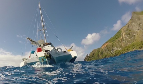
Photo: Aldebaran at Bounty Bay, 8kts of SE wind; and far away, Aldebaran at inside Tedside anchorage. (Uploaded by satellite)

View from the Bounty Bay Spire

From the anchorage at Bounty Bay we see a needle-sharp peak straight above the landing area, like a Matterhorn of the South Pacific. This is the view from the top of that peak – what we called the “Spire”. From here we can look at Adamstown on the left. Aldebaran is the little white speck on the far right of the frame. Captain Kristian is stoked this was our first landfall in the Pacific!

(Note: Photo upload by satellite)

Bounty-full Bay: The Secret Provisioning Stop

“Isn’t Tuesday, today, when the general store is open?” Asked Sabrina.

“Yes, but they’ll be closing at noon,” responded Charlene, as she hoisted our skiff out of the water.

“I’ll run you up there on my Quad,” she said. We were still scratching our heads that of the three days open for business, Adamstown works for only the first half of those days!!

Now we were having fun riding the Quads up the steep hill that leads from the dock to the town. The Quads are the favorite mode of transport in Pitcairn. They are open air ATVs (All Terrain Vehicles), similar to four wheeled motorcycles with loads of traction for the muddy steep slopes around the island.

‘A Bit of Everything’: that is how the general store was described. This understatement exceeded our wildest dreams; after our two years provisioning our sailboat in the hit-or-miss groceries of Central America, we were now in a store carrying a plethora of New Zealand products! Way out here in the middle of the Pacific!

Surely the prices are exorbitant though? Nope.. they are basically New Zealand prices. A bottle of gin was US$7. A block of Colby cheese US$4.50. Ginger snaps $2. Everything was very reasonable; and in anticipation of the jaw-dropping prices of French Polynesia, we decided to stock up Aldebaran’s pantries, which had been dented by our three week passage from Galapagos.

US$500 later, we had 5 large boxes stacked outside. Our lunch hostess Daralyne also made us whole grain loaves of bread for $4/loaf, and two sizeable boxes of fruit and veggies grown by locals on island were thrown into the mix for $40.

There was also informal provisioning occuring. As we visited people during the day, we were given extra watermelons (“they’re going to our chickens anyway”), hot peppers (“these buggers are bloody hot! You like these?!”), and kale bunches (“oh please take as much as you want, helps with pruning”).

All our boxes were delivered to the dock by Quad, and placed in the skiff, which was then effortlessly hoisted in the water. The locals’ helpfulness is to a fault, without any real pretension or expectation of return. They are just happy to assist whenever we mention it.

The hardest part of our Pitcairn provisioning effort was, naturally, getting the boxes of food from the dinghy to the sailboat. As the wind from the SE increased in strength, it got rougher. A lot rougher. Imagine handing over a case of wine to a person riding a rodeo bull while you’re straddling a feisty goat, and you’ll have an idea of the procedure.

But the most troubling part of the affair was that when we were re-stocking our galley and putting all our new provisions away — inside the supposedly ‘dry’ pantry — we discovered soda cans had exploded and got various things wet.

Gee whiz, we work so hard to keep the persistent water of the ocean and rainstorms out of certain “dry” areas, and then soda cans explode from the excess vibration?? Give me a break.. no more soda cans except in the cooler.

We were shaking our heads in amusement at the whole experience. We never imagined we’d be provisioning in little Pitcairn island; and that we’d find so much abundance! So we started calling it “Bounty-full Bay”.

True fact: loading food is a ton of work (we were up till after midnight cleaning, storing, and labeling things) and the dinghy process is tough. Monohullers may not want to stock up their boat at a rolly anchorage. Other than that, it’s a fantastic spot for yachts crossing the Pacific to stock up on affordable New Zealand goods, before going to the pricey and apparently limited selection of products in Gambier Islands of French Polynesia.

But who knows! Maybe we’ll be proved wrong down the road. Until then I’m enjoying my Kingston choc filled cookies.

Read more about Pitcairn and our voyage:
http://www.greencoconutrun.com/blog

Enjoy the photos, videos, and recipes on Green Coconut Run? Support by becoming a Patron and get sweet perks! http://www.patreon.com/greencoconutrun

Simon and Shirley

These are two of the few immigrants that didn’t marry into a Pitcairn family. Simon and Shirley moved here 20 years ago of their own accord. Simon is from UK and Shirley is from California, and both come from a farming/horticultural background.

Shirley heard our voices on the VHF radio when we announced our arrival, and she came to the docks to meet us– she was excited to talk to folks from the West Coast. Simon and Shirley have been wonderful with us– hosting fabulous Tea Time at 4pm from their balcony overlooking the ocean, letting us do laundry with their washing machine, and in this case, about to give us a pile of kale…

Cockpit view, 7am Pitcairn Island

Aldebaran’s cozy cockpit is partially zipped up for the rain that went by on Monday/Tuesday, and the nip of the breeze at this latitude. After the rain passed, the wind switched from NW to SE (it’s all sideshore and uncomfortable, but it’s been light wind below 10knots). Note our Garmin nautical chart keeping track of our movement in the anchorage and depth, with one of three anchor drag alarms on Aldebaran. This is truly an astounding view to wake up to, especially happy to know we haven’t drifted overnight! Here’s Sabrina coming out of our rabbit hole with a cup of tea at the ready (our aft cabin is down that ladder)

Land of the Individual, and Other Endangered Species

The text on Melva’s shirt read:

“Pitcairn Island: Land of the Individual, and Other Endangered Species”.

Melva is the tourism coordinator. In a world desperately intrigued by the “last white rhino” and the “end of Arctic Ice”, one of Pitcairn’s draws is its vulnerability.

It’s a double entendre. Pitcairn is a society of Individuals, and it is endangered. Everyone spoke about the need for immigration into Pitcairn, or else it’ll… disappear.

“When I was in school,” said Charlene, who does a harbormaster role, “there were a few dozen kids in the school. Now there are only 4.”

We visited the kids in the school, and even got Michael playing 4-square (a ball game) with them. They were super excited about us being there, and showed us around their school.

The school facilities were fantastic. But kids leave when they are 12 or 13 years old to live in New Zealand for high school, and it is not possible to return even during summer holiday- because the cargo ship schedule, which comes every 3 months, doesn’t coincide with their vacation. So they don’t return.

Without young people, the community is getting older… there hasn’t been a birth on Pitcairn in over six years. Isabel, the youngest girl in the island, had just turned seven the day we arrived.

The teacher is Ms. Liz, who is from New Zealand and has a year contract to teach in Pitcairn. The British government pays the salary, since this is a British Overseas Territory. Everyone on the island is getting paid by the British government to do a job (or two); and in addition, they earn revenue from tourism, either in homestays or with cruise ships which now visit the island.

According to Simon (our tea time host), there are 83 part time jobs available from the government for Pitcairn citizens. There are only 49 residents so most people have multiple part time jobs. Simon is the town magistrate, quarantine officer, and trail clearing guy. Charlene is the harbormaster and also the post office master.

The town is “open for business” on Tuesday, Thursday, and Sunday. That’s when the general store, post office, health clinic, and government offices are officially open. But they open on demand as well- just call them on VHF channel 16!

Pitcairn is a homesteader’s dream. There are trees laden with fruit drooping from every corner; gardens bloom with vegetables in each person’s yard; fish is plentiful; even the food imported from New Zealand is excellent are inexpensive. We were extremely impressed by their general store, stocked every three months by cargo ship.

And there’s more.. There are jobs for everyone (albeit at $10/hr); the health care is excellent and free; the climate is very comfortable; and the ocean is crystal clear.

But… it costs $1500 each way to get to New Zealand or Los Angeles, which at their local wage of $10/hr is a pretty penny. Furthermore, this must coincide with the cargo ship’s schedule. So access is a major obstacle.

Ironically, the same difficult access that creates Pitcairn’s magic in the first place also causes them to lose their kids to the outside world. The next generation isn’t returning like they used to. The difficult access that creates such unique individuals is also constricting their ability to sustain themselves, due to a modern world that demands mobility.

Therefore the Pitcairn citizen, the iconic Individual, is an endangered species, unable to adapt to the new environment of modernity.

We looked with bitter sweetness at the 4 kids playing in the school’s yard. A dark cloud drifts over many of the conversations with Pitcairners, foreshadowing the community’s decline due to the challenges of not keeping the youth around. There is already a nostalgia for the potential demise of Pitcairn… the loss of something pure, free, unique.

Pitcairn may seem like the ultimate simple life. It is a lush abundance of foliage and dreams; without aggravating rules and bureaucracy. Yet the compromise is that you’re stuck here. You get heaven, but you can’t leave (easily).

Lucky for us, when our time is up, our good ship Aldebaran is our gateway to leave Pitcairn. We tasted paradise but we are not stuck; later in the week, we’ll hoist sail and head 3 nights towards the Gambier islands, almost 300 nautical miles away. They are remote in their own right, but now our bar has been set high wiLand of the Individual, and Other Endangered Speciesth Pitcairn Island.

A Taste of Adamstown

The rocking at Bounty Bay anchorage was so intense that we woke up at 2am with the violent motion and couldn’t sleep. In comparison, sleeping under way at sea was a delight! Yet, our visit to Pitcairn’s “Adamstown” the next day made the night’s hardships more than worth it.

The town is named after John “Adams”, who was the sole male survivor of the civil war between the English mutineers from the HMS Bounty, and the Tahitian men that were brought as pseudo slaves. The colony blossomed under Adams’ leadership and he is a founding hero, in equal measure to the charismatic mutineer Fletcher Christian, whose surname is still held by about half the town’s residents.

After the poor night of sleep, we struggled to put the 15hp Suzuki outboard on the Lambordinghy, our 10ft inflatable skiff. The awful side swiping of the swells made this operation sketchy as heck; but we successfully installed the outboard, and motored to the inside of the protected breakwater. A white sign was proudly displayed above their launch ramp: “Welcome to Pitcairn”.

A group of five locals were there to greet us: the immigration, customs, police, port, and tourism officials. Several had bare feet which contrasted wonderfully with their official attires; they beamed with smiles and put beaded necklaces around our necks – their version of a Hawaiian lei – as we clambered from the skiff onto dry land for the first time in three weeks.

Our arrival — the vexing challenge of the anchorage and the locals’ buoyant welcome — was emblematic of the Pitcairn Experience. The exceptional difficulty of access is at the heart of why this community is so special. Because of the formidable effort needed to get here, the locals are by default self-reliant, individualistic, and genuinely appreciative of your presence.

Case in point, Aldebaran is just sailboat #12 to visit this year (2017); and the summer season of fair weather is nearly over, until November.

When we finally got our land legs under us and stopped wobbling, we climbed up the hill to “lunch at Darlene’s”. We were served a huge spread of home cooked casseroles and pasta, followed by an array of desserts. Melva, the tourism coordinator, had arranged for the museum to open for us at 1:30pm; but the lunch feast was running late.

“Oh don’t yous worry,” said our hostess Darlene in her Kiwi-islander accent. “I’ll ring the museum lady. She’s my mum.” She rung her mother on channel 16 of the VHF radio, which is a public channel that everyone monitors in the island.

We then relaxed into a cup of coffee and heard stories of their long boat adventures to the nearby atoll of Oeno for summer vacation, and to Henderson Island to harvest timber for construction and wood carvings.

This was an example of Pitcairn Time. There might be a certain English precision, where everyone is aware of time commitments. Yet, there is also total fluidity, where any change is just a VHF radio call away, and any change is ok.

We walked outside with bellies full and looked at the hillside. Over here was a garden of peppers, Hibiscus flowers, papaya, and pineapples. Over there were pine trees towering on the cliff edge. Banyan trees stood proud; their strings of roots looked like giant Rastafarian locks.

The landscape showed evidence of two centuries of efficient self-reliance. Manicured gardens merged into wild orchards of bananas and breadfruit trees; which gradually dissolved into the mossy jungle.

The path running past the buildings in Adamstown feels like an unassuming Fairytale. We see iron sheds for garden tools, the red and white Post Office building, people’s homes; all tidy and clean, even though the rusty materials and verdant trees seem to burst with life and conspire toward chaos.

Adamstown is like a well trimmed beard: people have given it their complete attention. The best reason for this is their industriousness; but it is also because the residents are always here…. Since it is very hard to leave, just as it was hard for us to arrive.

The winds will dictate when we leave too. We are short on diesel and will need a favorable breeze to sail to Gambier. A rain front is now supposed to move in and clear by tomorrow or May 3rd – we’ll exploring as much as possible in the meantime.

Parallel Universe

By Michael. Today I entered a parallel universe. Gone were the harried faces, the obvious signs of stress in a frantic modern society. Absent was traffic, cars, trucks, noise, traffic lights, stop signs. None of these existed. Gone was the screaming rush of the internet age with the constant urge to log on and email, text, and surf the web.

Was I in paradise? No, I was in Pitcairn, where the tiny population has to be one of the friendliest group of citizens anywhere. The fact that many are related helps. This is the land of laisser-faire. Want to build a house? You can design any house you want. Did I mention the land is free? There are no inspectors, no limits, just a self-regulated society.

I spent the most delightful afternoon with Simon and Shirley having tea. English Typhoo tea to be exact. But what most impressed me was the location. It was beyond stunning with a true 180 degree view of the waves crashing on a rocky boulders shoreline. In Malibu it would be a ten million dollar view. Here in Pitcairn… it was free. They just picked the spot, and boom, it was theirs. Simon cleared the land and built the house.

In this other universe, it’s possible that such things still happen.

Day 22. LAND HO! Pitcairn Island

By Sabrina and Kristian

In comparison with the blue horizon, clouds, and water we’ve been staring at for weeks, where seeing anything at all was worth noting, it was surreal to see a shape so extraordinary. Pitcairn island emerged from the ocean like a heavy-set cloud, more impressive and tall than we had imagined.

Over the course of our approach for 5 hours in light breeze, we could see increasing detail. The Canyons and peaks took shape. The imposing ridges became clear. Then we could see trees! What a delight after weeks on the ocean.

It was a lush green jungle of palms, bare crumbling steep cliffs and birds circling overhead. We feasted our eyes on all these details, hungry for so much variety. Look at the red rocks, the salt spray hanging above the foliage! Look at the pinnacles jutting out… and now the houses of Adamstown perched on the cliffs! It was all rather unbelievable.

Approaching the island reminded us of Isla del Coco: a tall rock sprouting in the middle of the ocean. Once we got close, it was reminiscent of home in the Channel Islands of California, yet morphed with tropical islands from fantasy paintings. It was fortress-like in its steepness, yet soft hued from the sun backlighting the sea mist, which clung to the cliffs.

Hearing the voices of the islanders over VHF with their strong Kiwi accents & jovial spirits caused our minds to wander with intrigue. ”Welcome to Pitcairn!” they beamed. It’s hard to imagine the lives of solitude and isolation Pitcairners have on this rock in the middle of the Pacific with only 49 residents and very seldom visitors.

We circumnavigated the tiny island of 2 miles before sunset to scope out potential anchorages. Everywhere was very rough, with intense surge and swell. We settled in at Bounty Bay for its good sandy holding ground, which would at least keep Aldebaran in place.

As night fell, the golden sliver of the Moon and the Milky Way traced an arc over the tall island. A few dim lights twinkled from the houses. Watching this magnificent scenery, a sense of accomplishment came over us. We had sailed three weeks to get here, which is the main way that Pitcairn gets visitors: approximately 30 yachts per year make a stopover.

We’re excited to go to shore tomorrow morning, weather permitting, and see what life is like here!