Broken! the Rudder Arm fails

Matt evaluates the damage to the rudder arm. The hole is where the rudder shaft is usually attached.

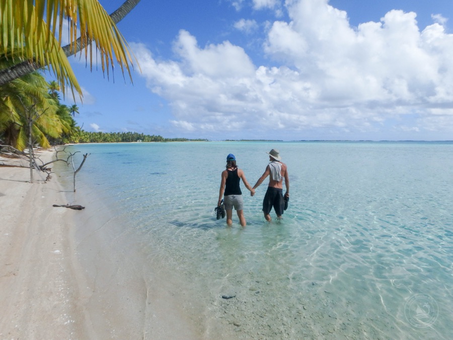
The rudder looked like a broken leg, flopped over to the side. “Oh no…” I thought. The last time I saw this we were in El Salvador and a bolt had come underdone. This time it was a lot more serious, and we were a lot more remote… 50 miles from the closest village in Tahanea, an uninhabited atoll in Tuamotos.

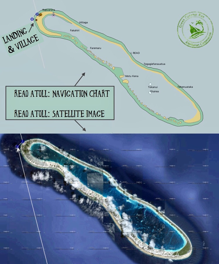
Satellite image of Tahanea’s west pass (ie. the gap of land in the upper part of the image) and middle pass (ie. in the lower part of the image). Just west of the middle pass is the so-called Middle Anchorage, which offers the best protection from the South-East trade winds, while still being near the passes (for diving, etc). However, it is exposed to the South winds.

Like El Salvador, we had just endured two rough nights at anchor. On the heels of a low pressure,  20-25kt South winds blew across Tahanea’s lagoon and caused 2 foot waves to crash onto our bow at anchor. Due to poor visibility from the rainstorm, we chose not to traverse the lagoon to find smooth water on the other side.  The lagoon is uncharted, and coral bommies can pop up from 50 foot depths to 3-5 feet deep. One of our sailor friends had hit a coral bommie when visibility had been reduced and was stuck on the rocks for 12hours, sustaining significant damage to the keel.

“Only traverse the lagoon when visibility is good,” was the word of warning. So we chose to stay in the exposed Middle Anchorage. Comfort-wise, we were fine on Aldebaran, but as the waves shuddered the boat backwards at anchor. Normally there is a rudder lock which keeps the rudder straight. However, the rudder lock failed and the waves overloaded the rudder.  This put an enormous amount of stress on the rudder arm, which is a stout but old cast bronze piece, and it cracked in half.

The coronel doing precision drilling on the piece we would use to “marry” the broken bronze rudder arm back together.

The failure of the rudder arm is catastrophic to the boat’s operation- it means we can’t steer the boat. The piece takes huge amounts of stress, and holds the stainless steel rudder shaft with a very specific “key-way”, so to fix it was a serious project. To avoid falling into desperation, we had to start a new company: Bad Ass Engineering. Company policy requires that we drink rum at regular intervals, speak with a southern accent, and git ‘er dune no matter what.

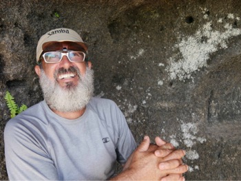
Laugh, so you don’t have to cry..

The Bad Ass  team  (aka B & A) crawled into Aldebaran’s wood locker and found some pieces of mahogany. We chopped them up and drilled lots of holes to connect them to the bronze rudder arm. This process took all day.

At least the surroundings were beautiful! Captain K taking the skill-saw to mahogany chunks while enjoying the backdrop.

The mahogany wood allowed us to “marry” the two pieces of bronze, using 11 bolts and 3 pieces of wood. We also added epoxy to bind the pieces and fill in the gaps.

The end result: ROBO RUDDER.

Robo-Rudder in all its glory. Note, the top right bolt had to be removed because it was catching on the bulkhead that supports the rudder. It was a very tight fitting space and we were lucky to find a solution that solidly put the arm back together.

Makemo Atoll, home of Leon and Soraya

“Leon, nous sommes arrivés!” Sabrina told our friend enthusiastically over the phone, advising that we had arrived. “Magnifique!” Leon responded, and told us how to find his house — distinctly salmon colored and hanging over the water’s edge 1/2 mile after the pass.

Aldebaran anchored in Makemo. Note how narrow the land is: there is no potable groundwater, so everyone must capture rainwater and store in tanks.

How often do we arrive in a new island after 500 miles of ocean crossing and have a local expecting us with cold beer and snacks?? The answer is never. Our connection with Leon came from a surprising place.

Motor sailing in light winds to Makemo

Continue reading

Deploying our Sea Anchor for the first time


Our 15ft Para tech sea anchor off the bow of Aldebaran before we paid out the rode.

Oh, the qualms of going “too fast”. We made better speed than we planned on our passage to Tuamotos… but it would put us at our destination (Makemo atoll) in the middle of the night. Instead of slowing the boat and spending the fourth night at sea, we decided to keep going full-speed and spend that last night in the atoll of Taenga. The catch is that we knew nothing about this atoll. 

  Continue reading

Farewell, Reao

The winds were dwindling in the forecast. We were enjoying our visit to Reao Atoll immensely, but if we were to sail the remaining 450 nautical miles to Marquesas, we had to make a move.

After touring us around all day, Marguerite then made a wonderful meal, also inviting the driver and his two companions. Watching the play of light over the lagoon in front of their patio, we felt an overwhelming gratitude at being treated as “insta-family” on this atoll. To add to boot, the driver and his friends prepared two boxes of coconuts and kava (like lychee) for us to take on the journey. What a gift!

Our visit had been too brief – with heavy hearts we bid farewells to our new friends. The goodbyes lingered; and suddenly dusk was upon us. Darkness was descending, and the whole village seemed to rally to ensure our safe departure.

Due to lack of visibility, the skiff captain took us back to Aldebaran in two trips. The maneuver was hair-raising; shining a spotlight ahead, he timed the sets of waves and expertly navigated the tiny reef keyhole to reach the deeper water. Meanwhile, two dozen people milled about the wharf, illuminated by moonlight, taking last minute photos with the rare visitors.

We set sail at 8pm going north with 12 knots of wind from the east. Behind us, Reao’s lights looked small in the vast black horizon. It reminded me of our departure from another tiny place: Pitcairn Island.

I felt that same terrible bitter sweetness. Goodbye, my friends, living in an isolated dot of ocean.

Here in Reao, more than anywhere, we felt extremely appreciated for simply coming to visit. In the “normal” world, it is rare to feel such deep gratitude for our mere presence and companionship – with no expectation of length of time, or exchange.

Besides the many surprises in this atoll – the sunken seaplane, harvesting clams (and octopus), the stages of copra, and the fabulous water – what we learned most from Reao was gratitude. There is no greater gift than deeply appreciating each other’s company, moment-by-moment.

Photo: Walking the placid lagoon in Reao… as they say in Tahitian, ‘Maururu’! Thank you!

Snorkeling the Airplane Wreck

It’s not every day that we come across an underwater plane wreck… much less one that we can snorkel around without any SCUBA. A truly unique experience in this remote Tuamotos atoll!

Photo: Captain K swims down to check out the plane’s cockpit. The plane has been in this watery grave in Reao Atoll since 1995. Photo by Spencer.

Fish in the Plane Wreck

By Spencer. We snorkeled out to the shallow crash site just a hundred yards from shore and began exploring. Beadle and I had weights and were able to dive down and under the wings without SCUBA (A rarity for wrecks) and I even did a swim thru the fuselage! The sediment in the water gave the wreck that eerie feeling that all wrecks have; however, as the sun shone through the clouds, the colors of the algae came to life. The engines were hairy with feathers of barnacles protruding from all over. Large clams had fixed themselves to the wreck, their lips shimmering beautiful greens, yellows, and blues.

One surprise: we dove down and peaked inside the wings, suddenly discovering hundreds of colorful tropical fish, which contrasted sharply with the grey metal carcass of their home (see photo at bottom). Inside the plane’s cockpit, springs jutted out from the frames of seats long decomposed. The port wing was the deepest of the wreck sitting in about 25’ of water; and under it large stripped yellow fish chased small red, white and blue fish back and forth. They occasionally misjudged their speed and hit the silty bottom causing a plume of dust to rise from the impact.

The placid nature of the lagoon has preserved the wreck very well and we were ecstatic when we swam back to shore. Capitan even jumped in the air squealing with delight when we got back to the truck. This was a superb and unusual way to break up the passage to Fatu Hiva.

There are more planes in the ocean, than ships in the sky

By Spencer.

A plunge into the lagoon’s cerulean waters revealed a wonderland of clams, sea cucumbers, and a plethora of fish who have made a home in the wreckage of an aircraft now resting on the bottom. This was the wreck of the Catalina, a sea plane that in times past was an atoll hopper bringing provisions, mail and people to and fro the remote atolls of the area.

In 1995 the Catalina landed as it had many times before; however, a chop in the sea and a gust in the wind that fateful day dipped the wing into the lagoon where the water was waiting to greet it for all eternity. The watery grave the plane sits in is on the edge of a shelf where the depth is only 5 meters and the broken starboard wing of the craft sticks above the water like a headstone.

(Cont’d)

Tour of Reao: Spirits and Clams

Our diesel Toyota pickup truck rumbled down the dirt road towards our first stop: a “marae”, the generic name for ceremonial sites used by the ancient Polynesians. All that’s left of the site are vertical stone slabs resting on horizontal stone walls. “We don’t come here much,” explained the driver. “We go to Church on Sunday.” The ancient spirits stay at rest in the marae.

Making our way towards the lagoon, we met a large, jovial lady and her companion sitting on upturned buckets on the water’s edge. They were cleaning hundreds of clams, removing their inside meat, which they freeze and send to Papeete.

“Look at this one with bright blue lips,” the lady motioned to us. “These are valuable. We ship them alive.”

Despite the lady’s swollen limbs from diabetes and filariasis (which causes elephantitis, or swelling of the limbs) she was positive and hard-working, and we enjoyed her company very much.

Clams are the main economic product from the waters of the lagoon. Marguerite pointed to the scattered buoys anchored in the blue water. The buoys are essentially a clam farm, which are harvested every few months.

Nevertheless, clams are minor as exports, compared to the massive copra agriculture, which covers nearly every plot of land on the atoll. A copra plantation was our next stop.

Sketchy anchorage, lovely people

It was 8am, the morning after our arrival in Reao. We were making a gameplan for the day.

“They say there’s a sunken sea plane in 10 feet of water in the lagoon,” Sabrina said over the VHF radio. “That could be amazing!”

“Whoa… okay, that’s worth the risk. I’ll pack snorkel gear for everyone in the big red bag,” I said. I had woken up alone on Aldebaran, where I had been on anchor watch. I mulled over the prospect of leaving our mothership at anchor for the day…

The anchorage was precarious. Although we dropped the hook in 100 feet of water, and it was still holding, the boat would swing around to anything from a depth of 70 feet (somewhat close to dry reef) to 250 feet (further offshore). It was quite steep – and we didn’t want her running aground, or getting blown out to sea! Luckily, today’s forecast was for lighter NE winds. A mental compromise was made: I’d go enjoy the day with the crew, and keep an eye on the wind.

Our rendezvous was at Gaeton and Marguerite’s house. After hosting the crew for an impromptu dinner last night, now they had hired a car and driver to show us around today. “It’s our treat,” said Gaeton.

Wow, what generosity!! we thought.

Gaeton went to work at the medical clinic. The Green Coco crew piled into a diesel Toyota pickup truck, along with Marguerite, who came as our guide; plus the driver; and two other guys, who seemed to be “going along for the ride”. We drove down the atoll’s thin strip of land.

Photo: View of Gaeton and Marguerite’s home, with the lagoon waters in front.

Arriving in Reao, final part trois

By Sabrina.

The town in Reao is on the north-western corner of the island. It is home to 350 inhabitants. The streets are lined with a continuous stone railing, white and fiddled, which stretches across town. It gives the place an oddly organized feel, in contrast with the corrugated metal houses and somewhat ramshackle appearance.

“Perhaps we should go back to the boat before it is pitch black?” I suggested to Spencer and Deena. “Let’s go find Pierre to tell him we are leaving.” The island has no restaurants nor hotels. As we rounded the bend, back to the main road, a car appeared and we were motioned to get in. Okay…

“On va ou?” I asked the driver, curious where he was taking us. He explained we were going to Gaeton’s house. We had met Gaeton earlier at the pier with his 10yr old son, Vahiria; they had driven their scooter to the breakwater to welcome us to Reao. Gaeton is a nurse by trade and now runs the town’s clinic. He moved here from France 14 years ago when he fell in love with Margerite during a visit to the island by cargo ship.

“Are they expecting us?” I asked our driver, suddenly feeling uncomfortable about ‘just showing up’ at this hour of the evening, but there was no turning back.

The house was on the far northern edge of the lagoon, about a 5 minute drive from town. Gaeton’s wife, Margerite, was standing outside awaiting our arrival! She welcomed us warmly into her charming coral-brick home, “La Maison du Lagon”.

The porch lights illuminated the chiseled white coral bricks, accented by natural wood. Their house was the nicest thing we had seen since the fancy hotels of Galapagos. It had always been Gaeton’s dream to build a tropical colonial house using natural materials. It took them 9 months to build the house themselves. Each brick of coral was hand chiseled and arranged with aesthetic precision. The inside of the house was just as exquisite. Margerite’s creations of shell and coral sculptures, necklaces, and chandeliers were artistically strewn all over the walls among weavings of pandanus and palm leaves. It felt like we had discovered a secret, magical place.

They made us feel like part of the family. They insisted that we should make ourselves feel at home and take showers (despite their very limited water supply, which all comes from rain). We were given clothes to wear as we were not prepared for an overnighter! It was a special evening for us all. We enjoyed a pre-dinner aperitif (a drink before dinner in honor of a special event), shared stories, and ate a delicious meal of crepes. Outside, the trade winds rustled the coconut trees, framing the gigantic blue lagoon just outside their porch. We wondered what was in store for us on this strange island on the following day.

Arriving in Reao, part deux

By Sabrina.

Our welcome party in Reao took us in a car to the other breakwater. A tractor towing an aluminum boat followed us through the streets, along with a growing entourage.

Reao doesn’t receive many visitors due to their remoteness and poor anchorage. They told us we are the first sailboat to arrive this year. The excitement on shore was palpable. More people showed up at the Southern Breakwater to introduce themselves to us; it felt like we were meeting the entire town. Their aluminum skiff was lowered into the water then zoomed out towards Aldebaran, through a “keyhole” in the reef. The keyhole looked like a channel from our vantage point, but waves also broke across it every few minutes.

After returning from Aldebaran, the skipper timed the sets and expertly maneuvered through the narrow 20 foot channel. It returned with only Deena in tow.

“Were you able to anchor?” I radioed to Kristian.

“Yup, I put out the delta anchor in 100 feet of water,” Kristian said. Our 33lb delta anchor is half the weight of our primary 66lb Bruce anchor, with a long run of line (instead of all-chain) which makes it better for deeper anchorages. We usually anchor in 20 to 50 feet, so this was a lot to ask for our hook. Kristian continued: “It seems to be holding well, but it’s precarious. I’ll stay on the boat overnight – you guys explore!”

By now the sun was starting to set. After many hearty introductions – and some discussion about whether Pierre gave us “permission” to stay on the island, we were then encouraged to go… walk.

Ahhh… walk where? I was also unclear what ‘staying on the island’ meant. Was this permission to walk around? Or permission to stay with someone?

Keeping in mind the setting sun, and the potentially long paddle back to Aldebaran, we went walking. A growing group of kids followed paces behind us. I tried to ask our entourage where we should go, but they were bashful and shrugged their shoulders as if they didn’t know. “What about your lagoon? Can we go visit that?” They nodded yes and pointed to a road ahead.

(cont’d)

Arriving in Reao, part 1

By Sabrina.
“They put us in the back of a pickup truck. I have no idea what’s happening or where they are taking us. Maybe someone’s house for dinner. Do you copy?” I said over the portable VHF radio, awaiting Kristian’s response. He had stayed on the boat, at anchor just off Reao atoll.

What started as bizarre and confusing, ended as a truly memorable 24 hours. Let’s back up a bit:

We had arrived in the 12 mile long atoll of Reao at 3:30pm. Like all the other atolls in Tuamotos, Reao is an oblong shaped ring of land which surrounds a large lagoon. Without a pass into the lagoon, nor any good anchorages, we were at a loss of what to do. Everywhere around the island plummeted to great depths of 300 to 500 ft, which is impossible to anchor.

With the binoculars, we could see people gathering by the breakwater, surrounded by small breaking waves over dry reef. With the boat adrift in neutral, Spencer and I shoved our essentials in a dry bag (radio, wallet, water, and long sleeve in case of bugs), lowered the Stand Up Paddle boards into the water, and paddled ourselves in. The clock was ticking as we only had a couple hours before dark to determine if we could safely anchor and visit.

The surge on shore was strong, and we nearly got swept off the cement steps that climbed up the side of the breakwater. The helpful locals assisted us by grabbing our boards and raising them to their makeshift cement wharf.

The crowd bustled around us. The chief introduced himself first. His name was so long, I was at a loss to even try and attempt to repeat it! He then said in French, “You can call me Pierre.” (Perfect, that’s my brother’s name!). The chief was a short, stout man, who stood about four and a half feet tall and carried a stoic expression.

“Welcome to Reao” he said, eyeing us with his head crooked. “How many days do you want to stay here?” His expression was stern with his eyes half open.

“I don’t know,” I replied. “We would love to come visit for a day or two, but we need to make sure we can safely anchor. Is there a spot we can move the boat that is less deep? Otherwise, we will have to take off. We came from Gambier and are making our way to Marquesas.”

Pierre directed me to another breakwater with a launch ramp for small boats, near where ships typically anchor. I radioed the information to Kristian.

(cont’d)

Map of Reao Atoll

The Tuamoto atolls are very bizarre. From the air, they are simply a ring of sand and coconut trees around a huge lagoon. There are more than 30 such atolls.

They are formed by old volcanos which sunk under their own weight, after geological uplifting was over. During that process, the coral reef developed around the crater. Normally, the volcanic island would simply sink into the ocean (as many old craters are sinking in Galapagos). What prevents this total disappearance is the prolific coral reef that keeps growing and feeding land into the island. Since it is purely coral substrate, there is no sediment (ie mud), hence the water is extraordinarily clear.

Reao’s lagoon is some 9 miles long, but there is no pass that allows boats to enter inside the lagoon. From the satellite imagery, we could see the village on the north-west corner of the atoll, with what looks to be a dinghy landing. That is what we were aiming for, as we had zero other information about this atoll.

Port-itis: the disease of getting stuff done

Delayed by a day! We’re now leaving Sunday morning April 9th on our passage. We are so exhausted from all the work of getting ready.
Thankfully we found these epic hats (best $3 spent!) that help us endure the hardships of passage preparation. Example of adequate head protection when scrubbing anchor chain in the burning tropical sun.

Port-itis: the disease afflicting sailors, suffering from the need to get stuff done when in port. The condition expresses itself in anxiety: “When I’m at sea, I won’t be able to do …. [insert anything modern here] so I better pack it all in now! ”

Seriously, I can’t wait to be underway and have less of this compulsion to buy boat parts, food, and send out emails.

Oh yeah and did we mention we bought more food?? Today is Saturday, an AMAZING fresh food farmers market here in Galapagos’s Santa Cruz Island, as good as anywhere we’ve seen… it took us three hours to put food away though, as the fruit and veggies must be individually wrapped in aluminum foil (carrots, oranges) or newspaper (Apples, cabbage), wax the ends of squash, and so many other details…

Mr. Payne aboard Aldebaran

Michael Payne

“Ever since I owned my own 40ft ketch – which dare I say was a lovely vessel – I’ve yearned to do this voyage. I’m 72 but I’m fit enough to do it, so it’s now or never,” said Michael Payne in his distinct British accent. 

“Yes.. very well,” I responded. “But Aldebaran is not a typical ‘yacht’… It is more like a VW Camper Van of the Sea, a community ship built in 1968 with lots of character..”

“So I’ve heard. But I wouldn’t want it any other way. In my 20s, I hitchhiked thru the middle east, and since then I’ve had some great  adventures, but frankly, this has been my dream for so many years.  Doing it with good people is more important than a fancy yacht. I couldn’t think of a better boat to do this passage with.”

And thus we signed on the one and only Michael Payne for our passage from Galapagos to Pitcairn and Gambier. He’s with us for 5 weeks sailing across the Pacific. 

You probably know our adventure cooperative’s motto is “Harvesting Stoke”. So it’s remarkable that we’ve rarely seen someone quite so stoked about being aboard the boat! Ever since Michael joined us a few days ago in Santa Cruz island of Galapagos, we’ve been flabbergasted at his genuine delight and keenness to live as we do. 


Sabrina made sure that Michael was wearing appropriate technical garb for hull cleaning. We dove in and scrubbed the boat’s three hulls so that we would reduce drag in the next 3000 miles of ocean passage.


This English gentleman, whose successful practice as a high end interior designer has spanned 30 years, had one primary concern: can we make a cup of tea aboard the boat? And is there milk for the tea?


We have our dear friend Erika to thank for connecting us with Michael, who is a family friend of hers. We have now added more wisdom (and joie de vivre) to our sailing community. And also to our passage across the Pacific!

The Final Provisioning Push


Spencer wasn’t sure if our rum stash was adequate so he decided to bring a personal addition. just kidding.


Two days to departure! Here’s how we are getting the ship stocked up for the trip… 


FOOD FOR A FEW MONTHS

We’ve done 98% of our provisioning, which includes a huge amount of shelf stable food in our pantry. The local supermarket in Puerto Ayora (the town in Santa Cruz island of Galapagos) was quite good and we got 3 shopping carts worth of food. This supplements the 4 shopping carts of food from Bahia Caraquez, Ecuador. 


all the food items need to be migrated into plastic bins for storage


Aboard Aldebaran we’ve got many kilograms of pasta, rice, flour, granola, and everything else you can imagine, all carefully stored in containers in different bins, or vacuum bags to prevent bugs and moisture. Organizing all this is a huge project in itself which Sabrina has been mastering. 


All that is left… on Saturday morning 6am we’ll buy fresh fruits and veggies at the farmer’s market and then get underway!! 

Oh yes, we also need to buy another case of wine – we discovered we can stack the boxed wine cartons under the beds 

🙂  

WATER FOR 30 DAYS

Along the way, we make water for drinking with our small capacity watermaker (1.5gallons per hour, running off our 12volt batteries) but we don’t like to run it inside harbors like Puerto Ayora. Unfortunately there are sooo many ships here running generators that the water smells like diesel. 


we’re hoping to catch lots of rainwater. A lot easier than carting around heavy jugs of water!


Recall there is no dock here in Galapagos to tie up to and fill water. So the main option is to pay a water taxi to bring us water, which costs about $50 for 100 gallons. 


We collect water from friendly tourist boats with these 5 gallon jugs. underway we keep these for our drinking water only


Instead we learned a trick from our buddies Diego and Carolina who live on a sailboat in San Cristobal: going to all the tourist cruise boats asking for water. They have massive watermakers with multiple filters and enough water to pressure wash their decks, so we ask them for 15 gallons at a time. With her sweet smile Sabrina asked all the boats here in the harbor and filled 100 gallons of water to top off our 140 gallon tank. Awesome! 

We estimate this will last us about a month for 4 crew member, with just over 1 gallon per day, which is kinda skimpy! The way we pull this off is by using a lot of salt water – to wash dishes, bathe ourselves, even for some limited cooking – and then do a final short rinse with fresh water. 

 We hope to catch some rainwater along the way with our new cockpit roof, and we’ll make a little surplus water whenever we are motoring and using our watermaker… although that is a very slow process.

FUEL FOR A WHILE

I’m not sure how long our 135 gallons of diesel will last, theoretically it can move us about 900 nautical miles. Our total distance to Gambier is close to 3000 nautical miles! Thankfully we are crossing the SE trade wind belt which is one of the most consistent breeze areas in the world, so we expect to arrive with plenty of diesel, in fact enough to get us to Marquesas (another 900 miles). 


we purchased a few cheap fuel jugs for diesel just for the passage, and since the diesel in mainland Ecuador was so cheap ($1.50/gal delivered; whereas in Galapagos it’s $3/gallon delivered)


We’re also bringing 20 gallons of gasoline for our dinghy and scuba compressor, which are efficient engines, and will hopefully be easier to replenish along the way…


Bob hanging out at the end of the rainbow on Isabela Island


The last “flammable” item is propane for cooking, which we have 2 big bottles worth (16lbs each). This is a tricky one as the propane fill in French Polynesia has unusual fittings, and it might be awhile before we’re able to fill those back up. Yet, those two large bottles should last us a little more than two months. 

Route Planning… to Pitcairn Island

 The faint line shows our proposed route from Galapagos to Pitcairn and onwards to French Polynesia. This is the software “Open CPN” which enables us to look at our route with overlays of wind, historical weather, and much more. Note the tropical low pressure just south of Tahiti is affecting the trade winds in the region of the “Austral Islands” such as Rapa. 

Talking about uniqueness of community… what Floreanna is to the Galapagos, Pitcairn is to the South Pacific. Is there another island in the world colonized by mutineers? 


So we are very keen to sail there, especially because it’s on the way to Gambier Islands, which look fabulous themselves. 

Only about 25 sailboats visit Pitcairn every year, a low number because of its isolation. Most sailors leaving from Galapagos head toward Marquesas. At latitude 10 degrees South, Marquesas is a remarkable downwind sail for almost 3000 miles along the trade wind belt. 

Meanwhile, Pitcairn, is at the low edge of the SE trade wind belt, like Easter Island, which is 1000 miles to the east. Its closest neighbor is Gambier islands of French Polynesia, 300 miles to the west. At 24 degrees south, Pitcairn is subtropical and its weather can be more fickle- it is influenced by low pressure systems in the southern ocean, particularly in June-Sep (their winter). 


This wind map shows the trade wind belt nicely, which is sandwiched by Galapagos (green circle) and Pitcairn (red circle). The trade wind belt moves north June-Oct. This software is Predict Wind, which communicates with our satellite phone (Iridium Go) to download weather updates wherever we are. 

Instead of going straight downwind, we expect a broad or even beam reach to get to Pitcairn. If we get unlucky, there’s even potential for close hauling (into the wind) during the last portion of the trip, as low pressures cause the winds to clock around. As we get to that point (3/4 of the way there) we’ll need to decide how best to weave our way there. 

The Southern Hemi summertime (Dec-Mar) would be more straightforward to sail to Pitcairn as the SE trades are more fully in place. As winter approaches the trade winds move north and the islands become situated in an area of wind variability. This is the main reason we are deciding not to head to Easter Island – it is a little too late in the season, and we don’t want to get “stuck” there. 

Unfortunately, Pitcairn’s only landing area is exposed to the predominant SE trade wind, and also the south swell, which makes it quite rough. This is none other than Bounty Bay, where the infamous ship Bounty was  burned and sunk by the mutineers in 1790 to hide their traces. 

No wonder Pitcairn was a good site for the mutineers. Nobody ever wanted to land there, the charts placed it in the wrong spot, so they could stay undetected! 

From what we heard several yachts try to stop at Pitcairn but keep sailing by because the anchoring conditions are too rough. So that’ll also be a test for us once we arrive. 

Calculations for arrival:

 Total distance from Galapagos to Pitcairn (via Dulcie atoll, in the Pitcairn group, add one or two days for a visit): 2800 nautical miles. 

Boat speed for Aldebaran: 3-8 knots

Boat average velocity made good: 4.5-5.5knots

Add one or two days at Dulcie atoll. 

2800 miles @4.5kts= 26 days +1 = 27 days

2800 miles @5.5kts= 21 days +2 = 23 days

Departure date: Galapagos, April 8

Estimated Arrival date: Pitcairn, May 1-5

Captain Spencer aboard Aldebaran

  
Our updated departure date across the Pacific!

–> Saturday, April 8th

I first met Spencer in the Santa Barbara anchorage in 2010 when we had both had recently purchased our boats: I had bought a 42ft trimaran named Aldebaran, and Spencer had bought a Islander Freeport 41 ketch named Okiva.

Our most memorable times were buddy boating to the islands, our two boats anchored together at Ladies’ Cove, at Cuyler Harbor, at Willow’s Anchorage. Such amazing trips!!
  
Spencer just turned 27 yrs old but is already a reknown sailing instructor in Santa Barbara, especially when it comes to advanced cruising skills (navigating around islands, anchoring in challenging conditions, etc). So we are incredibly fortunate to learn from his sailing knowledge, and natural passion for teaching, during the next three months. He is joining us now for the crossing from Galapagos to Pitcairn, and onwards to Marquesas.

Even more of a blessing is his joyful attitude. The guy just beams with positivity and good energy. He arrived March 22 nd and cruised with us around the islands of Isabella and Floreanna. We are now in Santa Cruz island, the busy hub of the Galapagos, getting the boat ready for our big ocean crossing.

Contact Spencer for sailing instruction at: Spencer@SunsweptSailing.com

Check out our Route across the Pacific:

https://greencoconutrun.com/our-route/season-3-south-pacific/

Sent via phone in Galapagos.

Snorkeling in Floreanna

Dozens of sea turtles go by the boat every morning – it must be their morning commute! They cruise around the rocks surrounding Black Sand Beach, which is the main anchorage in Floreanna’s town, called Puerto Velasco Ibarra. I imagine this black sand is silty, because the visibility underwater is not as good as other islands.

Perhaps because this isn’t a great site for snorkeling, things are more relaxed around here. Probably also because it’s a tiny town of 150 inhabitants with less tourist pressure; hence the capitania said it was fine for us to head to offshore rocks with our dinghy to go snorkeling. This is very unlike the other inhabited islands of Galapagos, where they only want you to go between your boat and the dock. In this way, Floreanna felt a lot more free than the rest of the archipelago.

We were happy as clams, heading a mile south of the anchorage to “Roca Botella” – as it looks like a bottle in the water. The viz was quite decent at 35 ft, there were tons of fish, beautiful formations in shallow and deep water, and some big parrot fish– although the surge was strong. The Aldebaran crew was stoked to be exploring!!

Photos: Check out this camouflaged “scorpion fish”, which Anna found. He didn’t move at all!

Birthday! and How to visit Floreanna

I woke at 5:40am after sleeping in the cockpit (to ward off the persistent sea lions from our dinghy…) Running lights from a sailboat appeared in the distance. It was none other than “The Beagle”, a replica of Darwin’s ship!

The Beagle is a cruise tourist boat. Private sailboat visits to Floreanna are now quite rare, dropped off to just one every other month – mainly because the Galapagos National Park strong arms the agents (who do all the boat permitting). They discourage visits to this island because they lack regulatory officials here to keep an eye on things. But all sailboats with an ‘autografo’ permit are technically allowed to visit “on the way” to another inhabited island. Fortunately we became friends with Jorge from Capitania in Isabela, who gave us this info.

Today I’m celebrating my 36th birthday and feeling super lucky for all this! Last night we were taught how to make delicious Yucca cheese patties called “mochin” by Angel and his wife Cecilia, who have been on the island 25yrs. People here are genuine and friendly unlike anywhere we’ve been. I feel blessed to be spending this week in such good company!

Photo: Sabby & I with friends Jesse and Anna, and “The Beagle” in background. Crewmate Spence taking the pic!

First Impressions of Floreanna Island…

We are anchored in the island of Floreanna, a place that breaks many rules… Although, the Galapagos is known for its flora & fauna, this island is most famous for its unusual inhabitants.

Another quirk: we weren’t really supposed to sail here… more on that later!

The story of the “murder of the Baroness” made Floreanna famous. It was set in the era of “back to nature” German pioneers circa 1930. Their crazy personalities became the focus, but it was truly the accomplishments of the ‘more-sane’ pioneers, living on this island with total self-sufficiency, that has blown us away.

We toured the highlands with Claudio (see photo), son of an original Ecuadorian settler in 1939 of the Cruz family. Naturally visiting the “Pirate Caves” was incredible, but it was Claudio’s stories that seemed out of a storybook. Making candles from cowfat. Making pesticides out of tobacco and chilli pepper infusion. The list goes on.

His ranch was mindblowing. Frigates did acrobatics to dip their heads in his lake-reservoir. An abundant overflow of crops and livestock was everywhere. Each tree had a story of when it was planted.

This is actually our first blog post via satellite, with 1 low resolution photo, and this much text allowed! Hope it works, and we’ll share more tomorrow.