The Tuamoto atolls are very bizarre. From the air, they are simply a ring of sand and coconut trees around a huge lagoon. There are more than 30 such atolls.
They are formed by old volcanos which sunk under their own weight, after geological uplifting was over. During that process, the coral reef developed around the crater. Normally, the volcanic island would simply sink into the ocean (as many old craters are sinking in Galapagos). What prevents this total disappearance is the prolific coral reef that keeps growing and feeding land into the island. Since it is purely coral substrate, there is no sediment (ie mud), hence the water is extraordinarily clear.
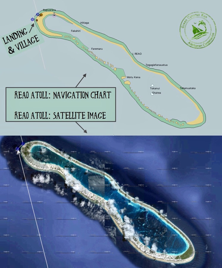
Reao’s lagoon is some 9 miles long, but there is no pass that allows boats to enter inside the lagoon. From the satellite imagery, we could see the village on the north-west corner of the atoll, with what looks to be a dinghy landing. That is what we were aiming for, as we had zero other information about this atoll.
Just wonderful to learn about all this…
About the atolls, how they are formed, why the water is so clear… Beauty!
And how exciting to ‘discover’ this infrequently travelled area and share this information with friends and fellow boat adventurers
Pingback: What are the Raffle Prizes? (Aug 19th) | Sailing Green Coconut Run