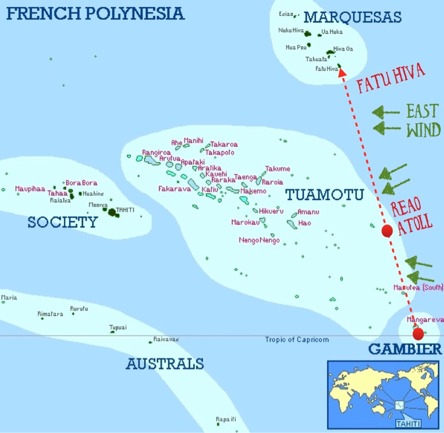
Here’s our route for this 760nm passage from Gambier to Marquesas. Generally the wind is favorable from the SE or E. However, there’s a NE or even N wind in the forecast, due to another passing front near Gambier. This means we may not have time to stop in Reao for long. The further north we go, the more reliable the easterly trade wind will be.
7 thoughts on “Map of Marquesas Passage”
Comments are closed.
Wishing you a smooth trip and hope you have enough time to tell us your wonderful stories about the people who live in these far away places
And of course take many photos!
Anyone know the story behind the naming of “Bay of Virgins” on Fatu-Hiva, where you’ve been anchored at your first port of call in the Marquesas? North American whaler’s dream destination? Sacrifice them to propitiate the gods from atop the soaring cliff behind Hanavave? An ancient myth, part of the oral tradition? Hanavave ‘export product’? ‘Imports’ from the larger islands? ‘Virgins’, a local fish, or…. There’s gotta be a good story there…
I guess not re: all of the above…..
Wikipedia sez>>>>
Hana Vave is the name of the northernmost bay on the west coast of Fatu Hiva. The bay is sometimes called the Bay of Virgins, a translation of the French name Baie des Vierges.
The French name originally given to the bay was Baie des Verges (Bay of Penes), because of the phallus-shaped basalt spires that rise on either side of its entrance.
According to a local Frenchman: The tricky catholic priests changed the name by altering one letter: from “Baie des Verges” (Bay of Penises) to Baie de la Vierge (Bay of the Virgin). Then wily sailors made it plural, calling it “Baie des Vierges” (Bay of Virgins); because for the deprived sailors, multiple virgins are better than one 😉
Pingback: The play of light | Sailing Green Coconut Run
Pingback: “Naná, Deena” | Sailing Green Coconut Run
Pingback: What are the Raffle Prizes? (Aug 19th) | Sailing Green Coconut Run